EXPLORING THE GEOLOGY OF THE ISLAND
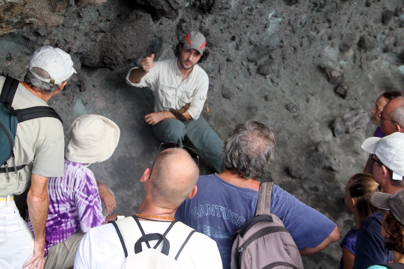
On May 22-17, we hosted Yves Mazabraud, PhD in Geology at the University of the Antilles, where he did research at the Laboratory for Research in Geosciences and Energies (LARGE). His very instructive visit included field trips to explore the island’s geology, and a lecture titled “Geological History of Saint-Barthélemy, The Earth’s Risks and Resources. The first field trip was with a ninth grade class on the north side of Anse des Cayes, where students could observe and analyze volcanic rocks and sediments as well as fossils. They were asked to reflect on an analysis of the landscapes, their modification by erosive agents such as rain and surf, as well as by human activities. They also discovered the principle called “actualism” to reconstitute the paleoenvironment of the deposits of sedimentary rocks and volcanic sediment by analyzing their surfaces and fossils on the one hand, and actual landscape and animals on the other, allowing the students to learn from local examples.
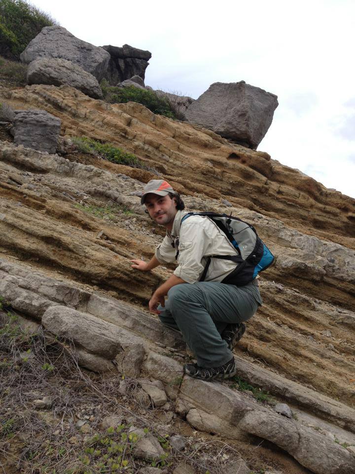
A Sunday field trip reserved for members of the association took place along the trail to Colombier, with an analysis of the landscape and coast, as well as the geological relief (the nature of the rocks and faults). This was also the occasion to go back in time 43 million years to imagine the formation and evolution of Saint Barthélemy, based on an analysis of the volcanic rocks found along the trail and their deformations (hydrothermal, faults).
The lecture on Saturday, May 26 drew a large crowd to the meeting room at the Capitainerie. The geological history of the island was described—from the creation of the Caribbean tectonic plate to the present time—as well as the origins of the various rocks that form Saint-Barthélemy. An accent was places on the immediate applications of research done by geologists in terms of sustainable development : prevention of natural ricks, the possibility of renewable energies, the importance of our natural heritage and landscapes. To close, Mazabraud presented a current research project that concerns Saint- Barthélemy and the northern Lesser Antilles islands. A project that has two phases: the first about the earth has already started and is a study of the geology of the islands of the Anguillan bank (age of the rocks, the paleoenvironments, the faults and their activity). The second phases will take place at sea as part of the oceanographic mission, ANTITHESIS, planned for December 2013. This project comprises scientists from the Antilles, France, Germany, Spain, and the United States to help redefine the geological history of the northern arc of the Antilles; with acoustic and thermal of the subduction zone around Saint Barthélemy in order to increase knowledge relating to large earthquakes and tsunamis.
A QUICK LOOK AT THE GEOLOGICAL FORMATION OF THE ISLAND
Like Saint Martin and Anguilla, Saint Barthélemy is above all a volcanic island. The three islands from the visible part of the “Anguilla Bank,” which in itself is a portion of the volcanic arc called the “Arc Ancien,” which runs from the Virgin Islands to Martinique. Volcanic activity took place here over a period of four million years (from 39 to 43 million years ago), when one can picture at least three volcanic cones erupting Saint Barthélemy, and although they are not very high in altitude, they spewed volcanic debris in the nearby lagoons to form volcano-sedimentary rocks (tuffs). At the same time, calcareous rocks formed in the lagoons. As a result, Saint Barthélemy is essentially formed of layers of limestone and volcanic sediment.